LPI NSW Topographic 1-25,000 Scale Maps
Hobbys Yard 8730-1-S NSW Topographic Map – Printed
$16.70 Inc. GST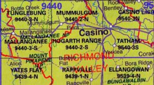 LPI NSW Topographic 1-25,000 Scale Maps
Hogarth Range 9440-2-S NSW Topographic Map – Printed
$16.70 Inc. GST

 LPI NSW Topographic 1-25,000 Scale Maps
Home Rule 8833-3-S NSW Topographic Map – Printed
$16.70 Inc. GST LPI NSW Topographic 1-25,000 Scale Maps
Hornsby 9130-4-S NSW Topographic Map – Printed
$16.70 Inc. GST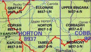 LPI NSW Topographic 1-25,000 Scale Maps
Horton 8937-1-S NSW Topographic Map – Printed
$16.70 Inc. GST

 LPI NSW Topographic 1-25,000 Scale Maps
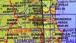
Huonbrook 9540-1-N NSW Topographic Map – Printed
$16.70 Inc. GST
 LPI NSW Topographic 1-25,000 Scale Maps
Huskisson 9027-4-N NSW Topographic Map – Printed
$16.70 Inc. GST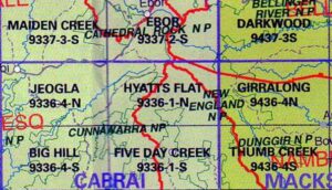 LPI NSW Topographic 1-25,000 Scale Maps
Hyatts Flat 9336-1-N NSW Topographic Map – Printed
$16.70 Inc. GST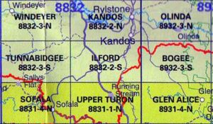 LPI NSW Topographic 1-25,000 Scale Maps
Ilford 8832-2-S NSW Topographic Map – Printed
$16.70 Inc. GST LPI NSW Topographic 1-25,000 Scale Maps
Indiana 9138-2-S NSW Topographic Map – Printed
$16.70 Inc. GST LPI NSW Topographic 1-25,000 Scale Maps
Ingar 9133-2-S NSW Topographic Map – Printed
$16.70 Inc. GST
 LPI NSW Topographic 1-25,000 Scale Maps
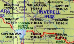
Inverell 9138-3-N NSW Topographic Map – Printed
$16.70 Inc. GST