 LPI NSW Topographic 1-25,000 Scale Maps
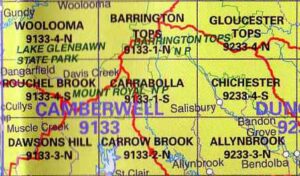
Carrabolla 9133-1-S NSW Topographic Map – Printed
$16.70 Inc. GST
 LPI NSW Topographic 1-25,000 Scale Maps
Carrowbrook 9133-2-N NSW Topographic Map – Printed
$16.70 Inc. GST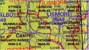 LPI NSW Topographic 1-25,000 Scale Maps
Casino 9540-3-N NSW Topographic Map – Printed
$16.70 Inc. GST
 LPI NSW Topographic 1-25,000 Scale Maps
Cathcart 8724-2-N NSW Topographic Map – Printed
$16.70 Inc. GST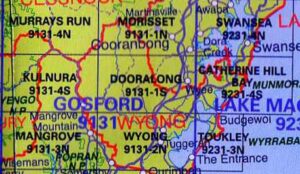 LPI NSW Topographic 1-25,000 Scale Maps
Catherine Hill Bay 9231-4-S NSW Topographic Map
$16.70 Inc. GST LPI NSW Topographic 1-25,000 Scale Maps
Central Tilba 8925-3-N NSW Topographic Map – Printed
$16.70 Inc. GST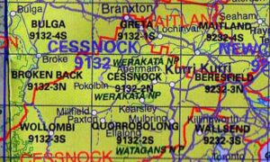


 LPI NSW Topographic 1-25,000 Scale Maps
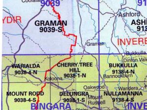
Cherry Tree Hill 9038-1-N NSW Topographic Map
$16.70 Inc. GST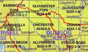 LPI NSW Topographic 1-25,000 Scale Maps
Chichester 9233-4-S NSW Topographic Map – Printed
$16.70 Inc. GST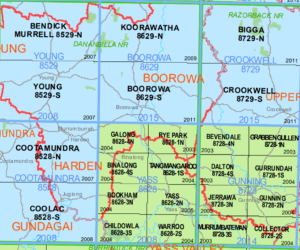 LPI NSW Topographic 1-25,000 Scale Maps
Childowla 8628-3-S NSW Topographic Map – Printed
$16.70 Inc. GST LPI NSW Topographic 1-25,000 Scale Maps
Chimneys Ridge 8524-1-N NSW Topographic Map – Printed
$16.70 Inc. GST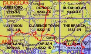 LPI NSW Topographic 1-25,000 Scale Maps
Clarence Town 9232-1-N NSW 1:25k LPI Map – Printed
$16.70 Inc. GST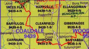 LPI NSW Topographic 1-25,000 Scale Maps
Clearfield 9439-1-S NSW Topographic Map – Printed
$16.70 Inc. GST LPI NSW Topographic 1-25,000 Scale Maps
Clevedon 9237-2-N NSW Topographic Map – Printed
$16.70 Inc. GST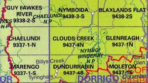 LPI NSW Topographic 1-25,000 Scale Maps
Clouds Creek 9437-4-N NSW Topographic Map – Printed
$16.70 Inc. GST


