 LPI NSW Topographic 1-25,000 Scale Maps
Cooplacurripa 9234-1-N NSW Topographic Map – Printed
$16.70 Inc. GST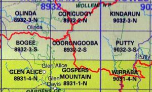 LPI NSW Topographic 1-25,000 Scale Maps
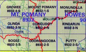
Coorongooba 8932-2-S NSW Topographic Map – Printed
$16.70 Inc. GST LPI NSW Topographic 1-25,000 Scale Maps
Cootralantra 8625-2-N NSW Topographic Map – Printed
$16.70 Inc. GST LPI NSW Topographic 1-25,000 Scale Maps
Copeton Dam 9038-2-S NSW Topographic Map – Printed
$16.70 Inc. GST
 LPI NSW Topographic 1-25,000 Scale Maps
Corang 8927-3-N NSW Topographic Map – Printed
$16.70 Inc. GST
 LPI NSW Topographic 1-25,000 Scale Maps
Coricudgy 8932-2-N NSW Topographic Map – Printed
$16.70 Inc. GST LPI NSW Topographic 1-25,000 Scale Maps
Corin Dam 8626-1-N NSW Topographic Map – Printed
$16.70 Inc. GST LPI NSW Topographic 1-25,000 Scale Maps
Coryah 8937-4-S NSW Topographic Map – Printed
$16.70 Inc. GST LPI NSW Topographic 1-25,000 Scale Maps
Cotter Dam 8627-2-N NSW Topographic Map – Printed
$16.70 Inc. GST LPI NSW Topographic 1-25,000 Scale Maps
Cougal 9441-2-1 NSW Topographic Map – Printed
$16.70 Inc. GST LPI NSW Topographic 1-25,000 Scale Maps
Courabyra 8526-4-S NSW Topographic Map – Printed
$16.70 Inc. GST LPI NSW Topographic 1-25,000 Scale Maps
Couragago 8627-4-S NSW Topographic Map – Printed
$16.70 Inc. GST LPI NSW Topographic 1-25,000 Scale Maps
Coutts Crossing 9438-2-N NSW Topographic Map – Printed
$16.70 Inc. GST LPI NSW Topographic 1-25,000 Scale Maps
Cowan 9130-4-N NSW Topographic Map – Printed
$16.70 Inc. GST LPI NSW Topographic 1-25,000 Scale Maps
Cowra Creek 8725-1-N NSW Topographic Map – Printed
$16.70 Inc. GST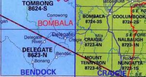 LPI NSW Topographic 1-25,000 Scale Maps
Craigie 8723-4-N NSW Topographic Map – Printed
$16.70 Inc. GST LPI NSW Topographic 1-25,000 Scale Maps
Craven 9233-1-S NSW Topographic Map – Printed
$16.70 Inc. GST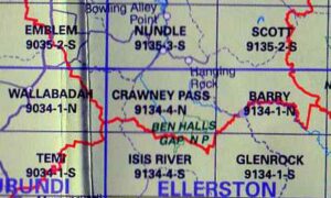 LPI NSW Topographic 1-25,000 Scale Maps
Crawney Pass 9134-4-N NSW Topographic Map – Printed
$16.70 Inc. GST


